Overview
West Bengal, a vibrant state in eastern India, is divided into 23 districts, each offering unique characteristics, cultural significance, and historical importance. From the bustling streets of Kolkata to the serene landscapes of the Himalayan foothills, the districts of West Bengal provide a diverse range of experiences. In this blog post, we will explore the 23 districts of West Bengal, highlighting their key features, major cities, and what makes them special.
Table of Contents
Alipurduar
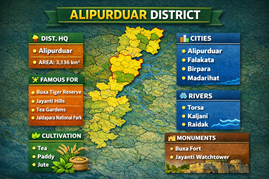
Alipurduar, established in 2014, is located in the northernmost part of West Bengal and serves as an important gateway to Bhutan. The district headquarters is in Alipurduar. Known for its lush forests and wildlife, Alipurduar is home to Jaldapara National Park and Buxa Tiger Reserve, which draw eco-tourists and wildlife enthusiasts from all over. The economy is largely driven by tea cultivation and agriculture, with rice and vegetables also being important crops. The district has an area of 3,136 km² and a population of 1.49 million (2011 census). The literacy rate is 77.47%, and the district has a population density of 523/km².
Bankura
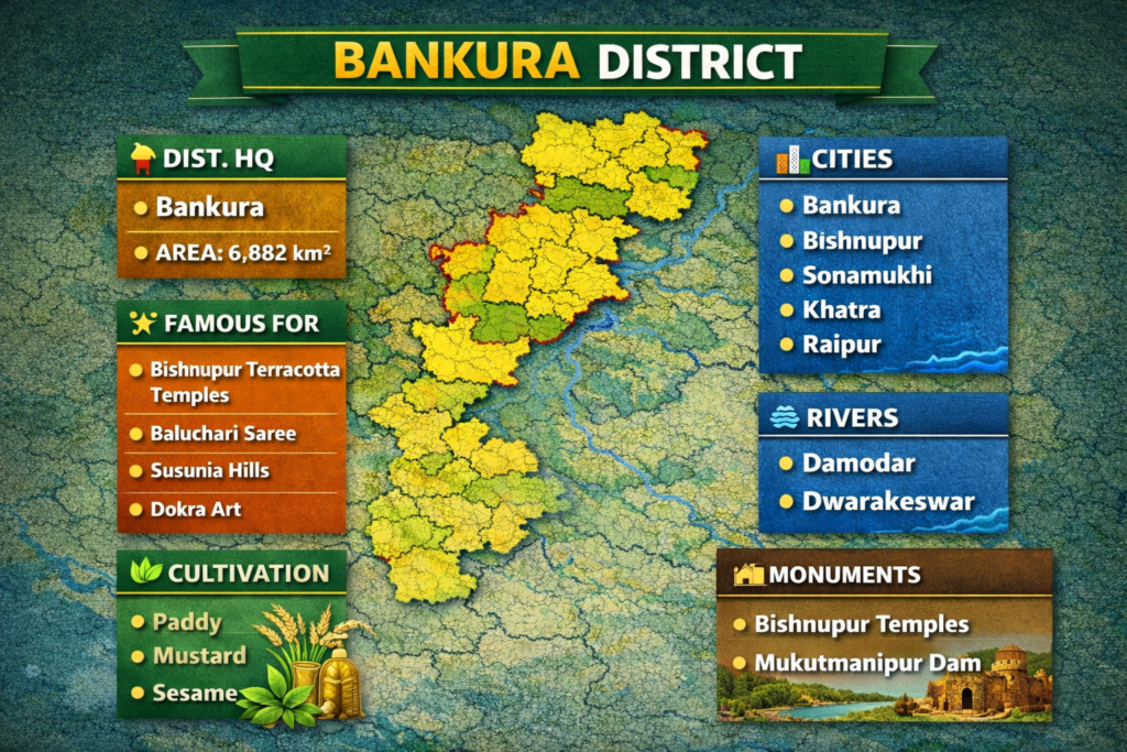
Bankura, established in 1947, is situated in the southwestern part of West Bengal. The district headquarters, Bankura town, is known for its rich cultural heritage and traditional handicrafts, particularly Terracotta Art. The district has several historical temples, including those in Bishnupur, renowned for its terracotta temples. Agriculture plays a significant role in the economy, with rice, pulses, and vegetables being the primary crops. Bankura covers an area of 6,882 km², with a population of approximately 3.60 million. The literacy rate stands at 70.95%, and the population density is 523/km².
Birbhum
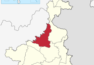
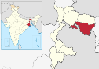
Birbhum, established in 1947, is located in the western part of West Bengal and is known for its cultural vibrancy, particularly the Shantiniketan area, founded by Nobel laureate Rabindranath Tagore. The district is home to many Baul musicians, Chhau dancers, and traditional crafts like Dhokra art.. Agriculture is the primary occupation, with rice, vegetables, and pulses being the major crops. Birbhum covers 4,545 km² and has a population of 3.50 million. The literacy rate is 70.9%, and the population density is 771/km².
Cooch Behar
Cooch Behar, founded in 1950, is located in the northernmost part of West Bengal and is known for its rich history and culture. The district’s headquarters, Cooch Behar, is home to the grand Cooch Behar Palace, a relic of the royal past. The district is famous for its tea gardens and agricultural products like rice, vegetables, and fruits. Cooch Behar has an area of 3,387 km² and a population of approximately 2.82 million. The literacy rate stands at 75.49%, and the population density is 833/km².
Dakshin 24 Pargana (South 24 Parganas)
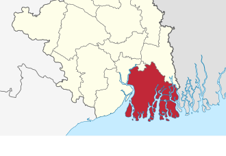
Dakshin 24 Parganas, located in the southern part of West Bengal, is known for its diverse landscapes, including the Sundarbans mangrove forests and a vast coastline along the Bay of Bengal. The district is rich in biodiversity, particularly home to the Royal Bengal Tiger in the Sundarbans Reserve Forest. Agriculture, especially rice, jute, and fisheries, plays a major role in the economy, with the region also contributing to Kolkata’s commercial activities. The district headquarters is Alipore. The district has a significant rural population, with many people engaged in farming and aquaculture. Dakshin 24 Parganas covers an area of 6,149 km² and has a population of around 8.1 million. The literacy rate stands at 78.5%, and the population density is 1,315/km².
Dakshin Dinajpur (South Dinajpur)
Dakshin Dinajpur, created in 1992, is a primarily agricultural district located in the northern part of West Bengal. The district headquarters, Balurghat, is known for its temples and natural beauty. Agriculture is the major occupation, with rice, vegetables, and fruits being the key crops. The district also boasts fertile lands and a rich rural culture. Dakshin Dinajpur covers 2,219 km² and has a population of around 1.68 million. The literacy rate is 73.86%, with a population density of 755/km².
Darjeeling
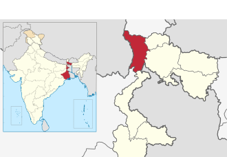
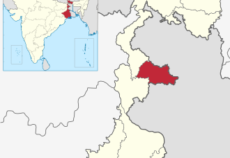
Darjeeling, established in 1947, is one of the most famous hill stations in India. Located in the northern part of West Bengal, Darjeeling is known for its tea gardens, scenic views of the Himalayas, and the world-renowned Darjeeling Himalayan Railway, a UNESCO World Heritage Site. The district also boasts a rich colonial heritage, Tibetan culture, and vibrant local markets. Darjeeling spans 3,149 km² and has a population of approximately 1.60 million. The literacy rate is 79.92%, with a population density of 732/km².
Hooghly
Hooghly, formed in 1947, is located in the southwestern part of West Bengal and is historically significant due to its association with the British colonial period. The district is home to Chandannagar, once a French colony, and Serampore, known for its educational institutions. Agriculture, particularly rice and jute farming, forms the backbone of the economy, alongside a strong industrial base. Hooghly spans 3,149 km² and has a population of 5.52 million. The literacy rate stands at 82.55%, and the population density is 1,753/km².
Howrah
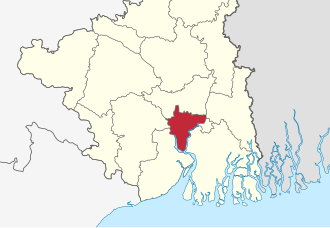
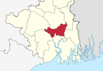
Howrah, created in 1947, is located on the western bank of the Hooghly River and is one of the most industrialized districts of West Bengal. The district is home to Howrah city, a major industrial and transportation hub, as well as the iconic Howrah Bridge. Howrah is also famous for Belur Math of which attracts thousands of pilgrims every year. The district covers 1,467 km² and has a population of around 4.85 million. The literacy rate is 83.85%, with a population density of 3,306/km².
Jalpaiguri
Jalpaiguri, established in 1947, is located in the northern part of West Bengal and is known for its tea gardens and wildlife sanctuaries. The district headquarters, Jalpaiguri town, serves as an important commercial center. Jaldapara National Park, home to the one-horned rhinoceros, is located here, along with the Mahananda Wildlife Sanctuary. Agriculture, especially tea cultivation, drives the economy, while tourism also plays a major role. Jalpaiguri spans 3,386 km² and has a population of approximately 2.38 million. The literacy rate is 73.79%, and the population density is 837/km².
Jhargram
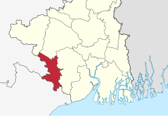
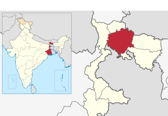
Jhargram, formed in 2017, is located in the southwestern part of West Bengal. The district is known for its tribal culture, Chhau dance, and lush forests. Jhargram is a hub for eco-tourism and tribal art, attracting visitors to places like the Kankrajhor Forest. The economy is primarily based on agriculture and handicrafts. Jhargram spans 3,037.64 km² and has a population of approximately 1.13 million. The literacy rate is 74.1%, and the population density is 374/km².
Kalimpong
Kalimpong, established in 2017, is located in the northern part of West Bengal, known for its beautiful hillscapes and Tibetan culture. The district headquarters is Kalimpong town, which is famous for its vibrant Tibetan monasteries and flourishing floriculture industry. Kalimpong also offers a serene environment with its picturesque views of the Himalayas, making it a popular destination for eco-tourism. The district has an area of 1,044 km² and a population of 251,642. Its literacy rate is 80.85%, and the population density is 241/km².
Kolkata
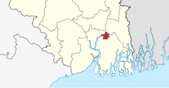
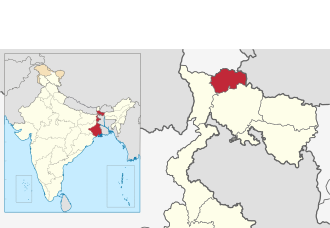
Kolkata, established in 1756, is the capital district of West Bengal and one of the most populous urban areas in India. Known as the City of Joy, it is a major cultural, commercial, and educational hub. Kolkata boasts a rich history, colonial architecture, and a vibrant arts scene, with iconic landmarks such as the Howrah Bridge and the Victoria Memorial. The economy is driven by sectors like commerce, IT, and manufacturing, with a significant focus on port activities. The district covers 185 km² and has a population of approximately 4.5 million. Its literacy rate is 87.14%, and the population density is 24,000/km².
Malda
Malda, established in 1947, is located in the northern part of West Bengal and is famous for its mango cultivation, particularly the Langda Mangoes. The district headquarters, English Bazar, serves as a commercial and educational hub in the region. Malda is historically significant, with ancient sites like Gaur and Pandua. Agriculture, particularly mango farming, plays a vital role in the economy. The district spans 3,733 km² and has a population of 3.99 million. Its literacy rate stands at 62.71%, with a population density of 1,069/km².
Murshidabad
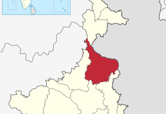
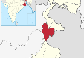
Murshidabad, founded in 1947, is a historically rich district located in the central part of West Bengal. The district headquarters, Baharampur, is renowned for its historical sites, particularly from the Mughal era, such as the Hazar Duari Palace. The district is also known for its silk industry and handloom weaving. Agriculture, particularly the cultivation of rice and jute, is an important part of the local economy. Murshidabad spans 5,324 km² and has a population of 7.10 million. The literacy rate is 66.59%, and the population density is 1,334/km².
Nadia
Nadia, established in 1947, is located in the eastern part of West Bengal and is known for its agricultural fertility and cultural heritage. The district headquarters, Krishnanagar, is famous for its terracotta art and Krishnanagar Palace. Nadia is also home to Mayapur, an important pilgrimage site for ISKCON followers. The economy of Nadia is primarily driven by rice and jute cultivation. The district spans 3,927 km² and has a population of 5.17 million. The literacy rate is 75.58%, with a population density of 1,316/km².
Paschim Bardhaman (West Bardhaman)
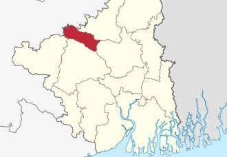
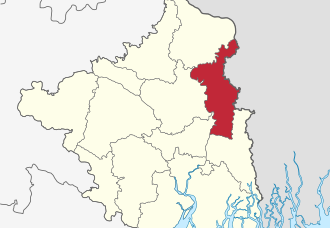
Paschim Bardhaman, formed in 2017, is an industrial hub located in the western part of West Bengal. The district’s largest city, Asansol, is known for its coal mining, steel production, and heavy industries, with a significant presence of companies like Bokaro Steel. Durgapur, another important city in the district, is known for its engineering industries and educational institutions. The district spans 1,603.17 km² and has a population of 2.88 million. It has a literacy rate of 76.21% and a population density of 1,798/km².
Paschim Medinipur (West Medinipur)
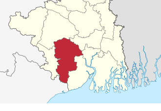
Paschim Medinipur, created in 2002, is located in the western part of West Bengal. The district is known for its agriculture, with rice, jute, and vegetables being the primary crops. The district headquarters, Medinipur, is a center for education, culture, and trade. Paschim Medinipur also has significant historical importance, with sites like Kharagpur, known for the Indian Railways training center and IIT. The district spans 6,308 km² and has a population of 4.78 million. The literacy rate is 79.04%, and the population density is 757/km².
Purba Bardhaman (East Bardhaman)
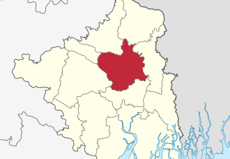
Purba Bardhaman, created in 2017, is an agricultural and industrial district located in the central part of West Bengal. The district headquarters, Bardhaman, is historically significant and houses the famous Bardhaman Rajbari. Known for its rice and jute cultivation, Purba Bardhaman is also a key player in the state’s mining sector, with the Raniganj coalfields contributing significantly to the coal industry. The district covers an area of 5,432.69 km² and has a population of over 4.83 million. The literacy rate is 76.21%, and the population density is 890/km².
Purba Medinipur (East Medinipur)
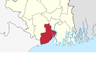
Purba Medinipur, formed in 2002, is located in the southeastern part of West Bengal. The district is known for its fertile soil and agricultural productivity, particularly in rice and vegetables. The district headquarters, Tamluk, is a historical town with significant cultural landmarks. Haldia, an industrial hub, is also located in the district and is known for its ports and chemical industries. Purba Medinipur covers 4,785 km² and has a population of 5.10 million. Its literacy rate is 87.66%, and the population density is 1,076/km².
Purulia
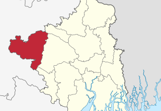
Purulia, established in 1956, is located in the westernmost part of West Bengal and is known for its scenic hills, forests, and Chhau dance. The district headquarters, Purulia town, is a center for the Chhau dance, a traditional martial art dance form. Agriculture is the main occupation, with rice and vegetables being the primary crops. Purulia is also home to Ayodhya Hill, a popular spot for trekkers and nature lovers. The district spans 6,259 km² and has a population of 2.93 million. Its literacy rate is 65.38%, and the population density is 468/km².
Uttar 24 Pargana (North 24 Parganas)
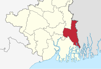
Uttar 24 Parganas, located in the northern part of West Bengal, is known for its urban and rural mix, with significant agricultural and industrial activities. The district is situated along the eastern banks of the Hooghly River and is a key part of the Kolkata Metropolitan Area. The economy is driven by agriculture (mainly rice, jute, and vegetables), fishing, and industries such as manufacturing and textiles. Uttar 24 Parganas is also home to the Dakshineswar Kali Temple. The district headquarters is Barasat, and the region is well-connected to Kolkata. Uttar 24 Parganas spans an area of 4,092 km² and has a population of approximately 9.6 million. Its literacy rate is 80.09%, and the population density is 2,351/km².
Uttar Dinajpur (North Dinajpur)
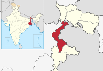
Uttar Dinajpur, established in 1992, is located in the northern part of West Bengal and is known for its agricultural richness. The district headquarters, Raiganj, is an important commercial and educational center. The district has fertile land, and rice and vegetables are the major crops. Uttar Dinajpur also offers scenic beauty with rivers, forests, and temples, making it a hub for eco-tourism. The district spans 3,140 km² and has a population of 3.00 million. Its literacy rate is 60.13%, with a population density of 958/km².
Announcement of New Districts
On 1st August 2022, the West Bengal cabinet approved the creation of seven new districts, increasing the total number of districts in the state from 23 to 30. The new districts are:
- Sundarban District – carved from South 24 Parganas.
- Ichhamati District – carved from North 24 Parganas.
- Basirhat District – also carved from North 24 Parganas.
- Ranaghat District – carved from Nadia.
- Bishnupur District – carved from Bankura.
- Jangipur District – carved from Murshidabad.
- Berhampore District – also carved from Murshidabad.